Spatial SQL Cheat Sheet, Podcast & Shaded Relief Images 🏔

On the horizon 🏔
Releasing this October 2022 at North American Cartographic Information Society’s annual meeting. Eduard is a relief shading application using the Swiss style with many great features and flexibility. Take a look at the homepage for more info and features.
 Bernie Jenny, Monash University, Melbourne
Spatial SQL Cheat Sheet 💾
Prepped a cheat sheet for spatial SQL, which is an essential tool for processing geospatial data stored in a tabular format adopted by RDBMS (e.g., Postgis) & scalable spatial data platforms (e.g., Apache Sedona) 👇🏽 #gischat #geospatial #database #SQL #DataScience pic.twitter.com/sfjTui6aJL
— Mo Sarwat (@MoSarwat) September 19, 2022
Podcast 🛸
This week on episode one of the podcast, I give some thoughts on our article last week on Zillow's bike problem also I take a look at the NYC 311 application developed by Chris Whong. This is a great application that explores the use of open data and user interaction to help people understand the world around them.
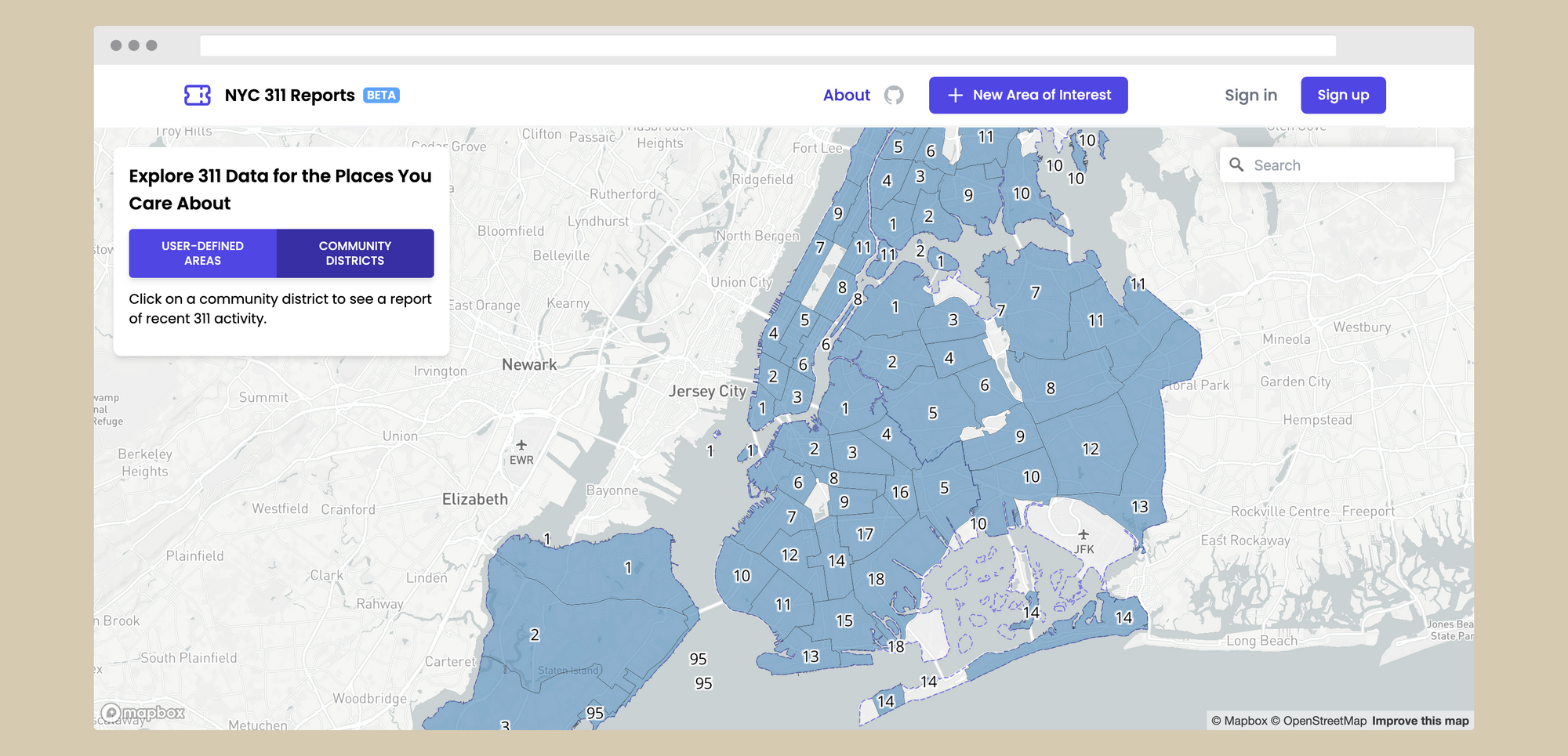
We also ask the question "how do you define a neighborhood? A question I believe is more complicated than it seemed to me at first. Take a listen here on Youtube:
on the playlist🔮
It's back and just in time for fall. Chillhop Essentials Fall 2022.