Felt - It's Canva with maps 🎨

Many industries have sprung up as the nature of work has changed. Think of apps like Calendly or Zoom. Think of the new features added by apps like Slack with video chats and threads adding the room for more collaboration and more communication. In this ever changing landscape, Felt has emerged as a innovative solution to creating maps collaboratively.
One of the first things I noticed about this application was the ease of which I could get started. You can be precise or general. You can draw polygons and create new shapes with ease, no edits, no layers, just draw and go.
Felt brings tools from professional geospatial software and packages them in a sleek toolkit that anyone can use. Understandable icons, let users create points, draw polygons, trim data and more.
Geodatabase, shapefile, Geopackag, KML, GeoJSON, OSM PBF, CSV, KMZ, GPX, are all supported by Felt with more file support being added each day, per the Felt F.A.Q. page.
Thinking of other map applications like this, Google maps being the closest thing I've seen, Felt is something different. This did not feel like a map builder with more features, rather it felt like a re-thinking of what mapmakers want in an application. Not everyone needs the horsepower or features behind the flagship geospatial applications, not to mention the price tag.
Felt is to ArcMap what Canva is to Photoshop.
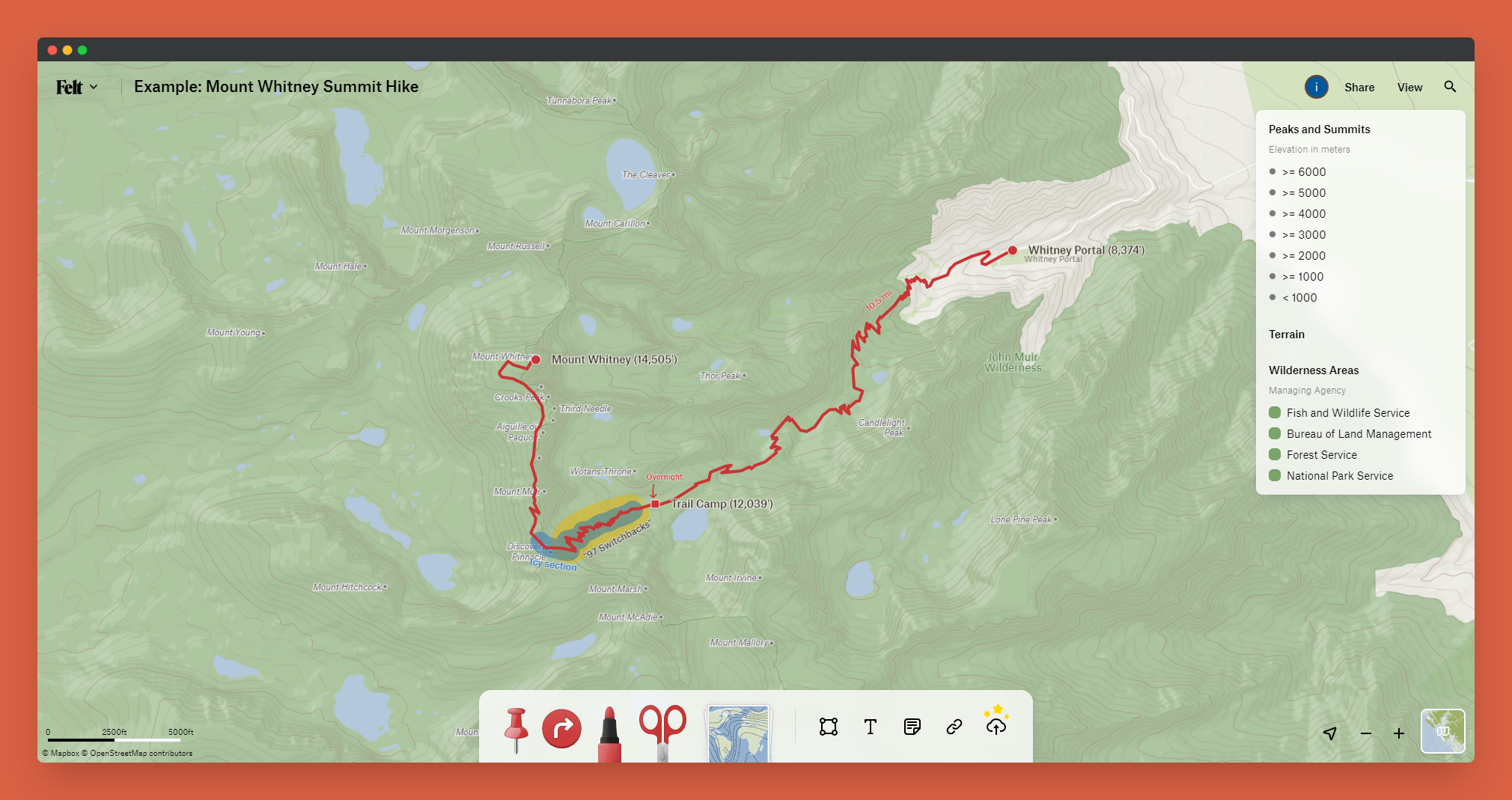
There are so many incredible use cases for this application. The collaborative nature of Felt makes it one of the best tools I've seen for planning trips with groups. You can import points of interest, make notes about locations, load in basemaps, and measure routes. The possibilities are really incredible with a tool like this, take a look at this great example of an Appalachian Trail hike planned with Felt.


